self-portrait-2
A BRIEF HISTORY OF THE VILLAGE
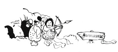
Souldern, in earlier times known as Sulthorn because of the many thorn trees which grew there, is one of a number of villages skirting the Cherwell Valley, situated just above the flood plain of the river. Here the porous Great Oolite series of the high ground to the east outcrops on to the Lias clays of the valley floor. From the limestones of the former the village receives an abundant and unfailing supply of excellent although very hard water at two springs, the principal one being the old Town Well near the Pond; the other is St. Chad's Well beyond Park Lodge. The precise siting of the village was probably determined by these. In addition the Oolite rim yielded good quality building stone from the many small quarries nearby. There would of course be no shortage of straw for thatching; practically all the house roofs were built to a thatch pitch.
An ancient Saxon road called Aves Ditch ran through the centre of the village to be joined later by the Roman Port Way leading on through Aynho. The intrusion of the Norman feudal estate at Aynho, planted there after the Conquest in 1066, blocked off the old tracks to travellers, forcing them to make a detour round the estate. The turnpikes, made in 1793, followed the new tracks, thus leaving Souldern in a cul-de-sac as it is today.
The first mention of the Parish Church, St. Mary the Virgin, was the burial there of William de Say in 1161; it was built by the de Say family a few years earlier. The earliest parts of the Church are the tower and the north wall of the nave which, together with the north doorway, date from the second half of the twelfth century. About 1300 the chancel and the south aisle were rebuilt. In 1775 the condition of the chancel led to its being pulled down and a smaller one erected. At the end of the nineteenth century a new chancel and organ chamber were built to designs by Bucknell and Ninian Comper. In 1906 the west tower was taken down and rebuilt.
Jordan de Say was the first feudal lord to be installed at Aynho by the Conqueror. The Domesday Survey carried out at this time did not include Souldern. The old Saxon Manor, situated near the church, was never occupied by the new lord himself, but was used as the Reeve's house until it passed into the ownership of the Throckmorton family in 1571 when it was renovated. In about 1655 the then owner, Bernard Weedon, pulled it down and built the existing Souldern Manor on its site overlooking the valley. An earlier member of the same family, John Weedon, was responsible for the Enclosure of 1613, one of the earliest in the country, by which the villagers lost their common grazing rights, most of the land being fenced off under private ownership. By the same Act, however, the commoners were allowed to retain some 13 acres to be known as Poor's Allotment, in compensation for their lost privileges. Poor's Allotment, together with several later bequests, has been consolidated into Souldern United Charities.
Souldern suffered badly during the Civil War, caught between the demands of the King stationed in Oxford, and the marauding bands of Parliamentary troops. At one time about 20,000 of the latter were camped in the area. Perhaps because of the strong Roman Catholic influence in the village Souldern sup: ported the Cavaliers, but no doubt the desecration of the church by Cromwell's troops, and other depredations, persuaded it to favour the King.
The village population is estimated to have been 200 in 1300, rising to more than 600 by 1851, and officially 355 today. Until recently it was largely self sufficient in economic terms, based on farming, with some dozen smallish farms. Many of the labourers, too, had allotments and kept pigs and poultry to supplement their meagre wages. Souldern Mill served this and local communities by grinding their barley, oats and wheat as required.
More recently the character of the village has been altered by the influx of many commuters and retired people who now make up about half the population; no doubt the proximity of the M40 motorway will accelerate such change.