Drone Use — RAF Croughton
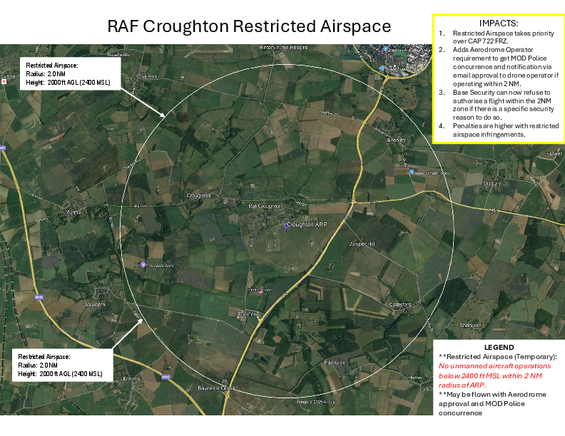
Please find attached a form provided by the Ministry of Defence Police (MDP) containing information about the restricted airspace over RAF Croughton in relation to drone use. The form is available for use by anyone who may be considering flying a drone in this area and also includes a map showing the two nautical mile (2 NM) exclusion zone to make precise locations of the restrictions clearer to those interested.
I would kindly ask that you share the document amongst the community to help raise awareness of the airspace restrictions and support safe and compliant drone operations.
Please do reach out if you have any questions, and I will ensure these are directed to the appropriate person.
Kind regards,
Abby
Abigail Jeffs
BA (Hons), PGCE, NPQLT
Community Relations Adviser
RAF Croughton | US Visiting Forces Support Group